There is no question that this has been a frustrating winter for snowlovers in the northeast. Each time we’ve had that hint of snow on the long range forecast it doesn’t seem to have managed to materialize. This progressive pattern we’ve been locked into has a number of different factors that could potentially impact where we are, including the persistent positive phases of the NAO and AO as well as the La Nina. This can favor less amplified wave patterns that cutoff the persistent source of cold air required from the arctic to bring some opportunities for snow when a storm develops.
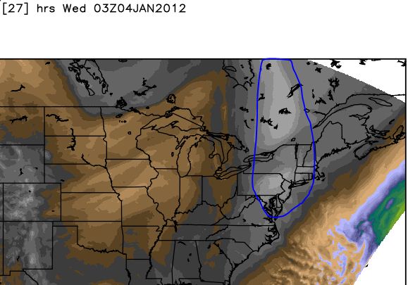
If you look at where things are now, we have exactly what people have been looking for in place today – A nice arctic airmass:

You can see the incredibly dry air coming down from the north with that air mass, but at the same time you can also see the moisture over the plains where some larger warm anomalies have built up. Without the blocking to anchor that cold air in – it just gets rooted out once again by the overall synoptic flow.
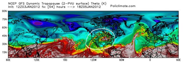
The other thing that really look disconcerting at least going into the next 7 days can be seen on the Potential Vorticity map:

You can see that expansive ridge over the central US. Those bright colors mean you have a high dynamic tropopause as a result of warm temp anomalies and increasing thicknesses.
The overall pattern in the next 10-15 days looks to be above normal with a few of these quick hitting cold shots like we have today. If we can get a snowstorm to coincide with one of this arctic blasts, we may be in business. At this point however – I’m still not all that optimistic about the availability of cold air.
Leave a comment