DISCUSSION: A Weak cold front pushed offshore Wednesday night and High Pressure in control over Southern New England today. To our east a vigorous shortwave trough and a coastal low are located over the Canadian maritimes. A large upper level ridge over the Eastern half of the country and a sharp trough on the west tell the rest of the story. A shortwave trough approaches the northeast tomorrow – centered over the eastern great lakes region.
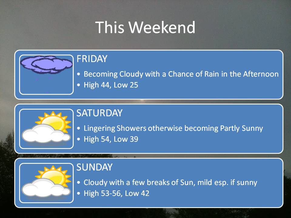
FORECAST: It should start to cloud up during the day on Friday. Rain is possible during the afternoon. Saturday and Sunday look unseasonably warm. If we get get some sunshine temperatures could exceed the 50’s in some places. We start to cool down a bit next week as a strong cold front comes through the area in the Monday-Tuesday time-frame. Even then, temperatures may still only fall to near or just-above normal for this time of year.
Here’s a look at the Weekend Forecast at a glance – Have a Great Afternoon!

Leave a comment