An upper level ridge will be building in the east towards the beginning of next week, which makes it possible for storm development offshore to menace the east coast. An area of interest just off the east coast of Florida as a low pressure system develops north-northeast. Models diverge on where this storm is going, the GFS doesn’t develop it a whole lot and takes it right out to sea. **UPDATE The GFS 12z, still out to sea, but significantly closer to the coast** The ECMWF 0z has a more intriguing solution:
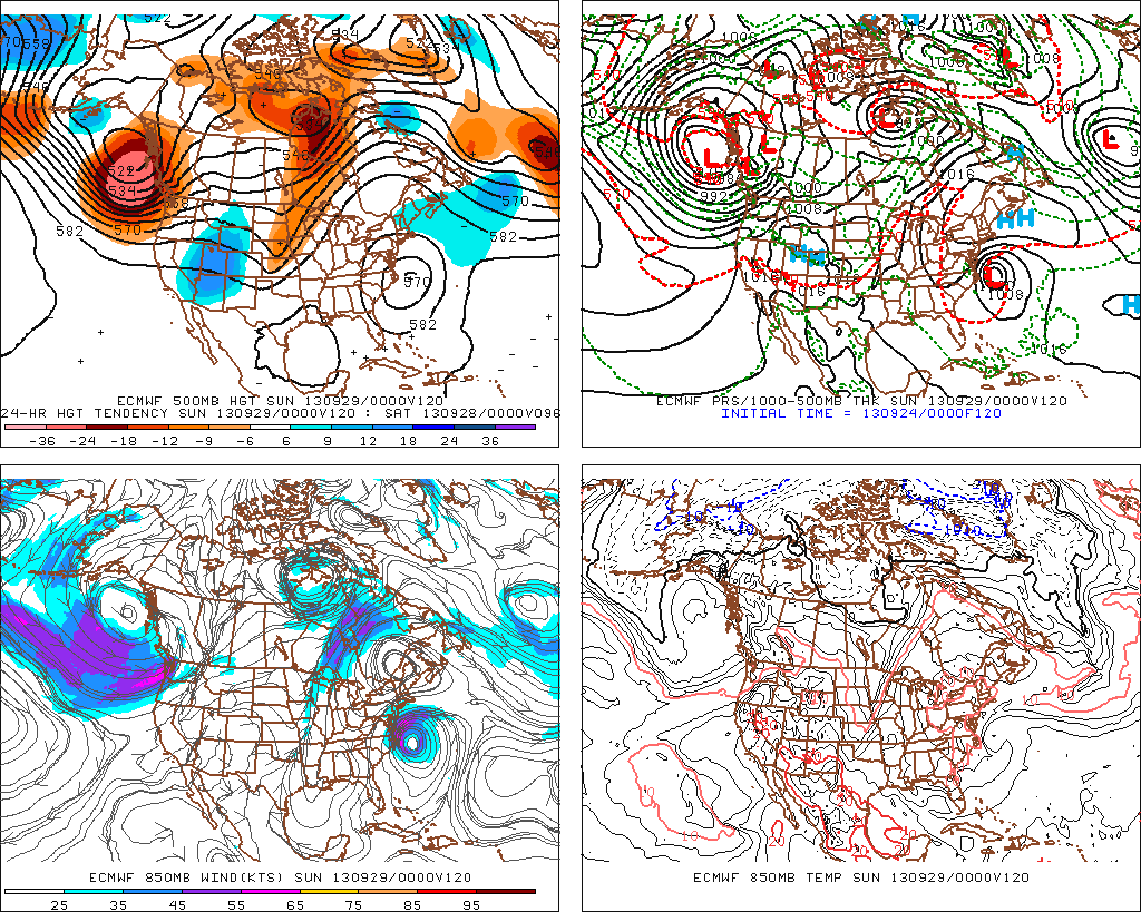
The Euro tracks this storm very close by, and suggests that a significant storm system could affect the east coast. At this point it’s just something that has to be watched. In the meantime, enjoy the nice weather for the rest of the week.

Leave a comment