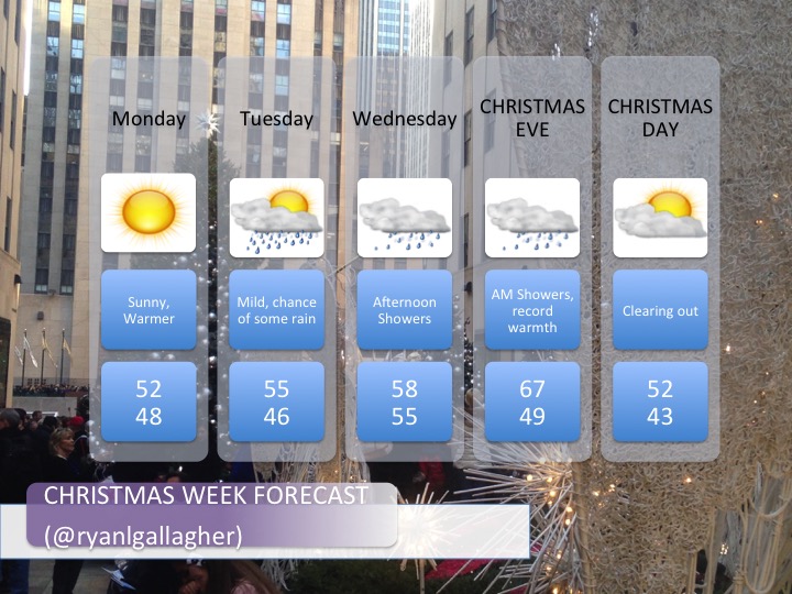
Now that we’ve ruled out a white Christmas, let’s see what this week’s weather will bring us. Warmth with a couple rounds of unsettled weather appear likely, but will it be enough to spoil Christmas in Connecticut?
Discussion:
Upper level: Some ridging is moving into New England this afternoon. This gradually works its way east through midweek. A trough enters the pacific northwest on Monday, will dig in across the rockies, and then lift up across the central plains. Out ahead, a strong ridge will build up centered near the east coast.
Surface: High pressure is in control, centered just to our southwest. It moves offshore beginning tonight and its clockwise flow will begin to usher in warmer air. A warm front approaches tonight and Monday as weak surface low tracks up into western New York followed by a weakening cold front. A more vigorous low pressure system develops near the Oklahoma panhandle, rapidly deepens and tracks up into the great lakes region by Wednesday. This should open the flood gates for warm weather for much of the US east of the Mississippi River with high pressure anchored well offshore in the atlantic. Record warmth likely. A cold front finally approaches Christmas eve and later moves overnight. Unsettled weather is expected midweek with rain chances anytime between Wednesday and christmas morning.
Forecast Graphic:

Leave a comment