An active weather pattern continues across the eastern US. The early part of the forecast period starts mild, with more seasonable weather returning for the weekend.
Discussion:
Upper level: A weakening trough approaches from the west on Friday. Ridging returns for the weekend as the trough departs. Another trough approaches the region in the beginning of next week..
Surface: A frontal boundary is setting up over central New England today between warm air and southwesterly flow surging between a developing low pressure system in Kansas and a departing high in the atlantic and cold northerly flow on the east side of an anticyclone in Canada.
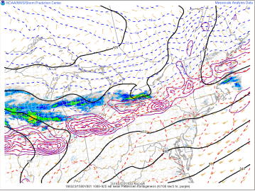
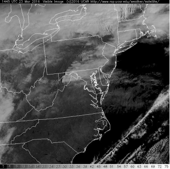
Today: A mix of sun and clouds is the theme today in southern Connecticut as high pressure continues to influence the southernmost portions of our area. This will continue to depart to the east today. The frontal boundary in central New England will creep south into tonight towards southern New England bringing some increased cloudiness to the area. Rain showers are possible (most likely near the CT/MA border) overnight tonight.
Thursday: Low pressure tracks through the great lakes region and then well to our north and west. Connecticut will remain in the warm sector of this system throughout the day with mild temperatures and a lot of cloud cover.
Friday: Cold front approaches early, bringing with it a line of showers through the region. Mild early, generally remaining cloudy and turning cooler at the day goes on.
Weekend: Clearing and cooler temperatures return as high pressure takes control.

Leave a comment