Discussion: A dry weekend in tap. Above normal temperatures return for the 2nd half of the weekend.
Summary: Weak high pressure maintains control. A weak warm front reaches the southern periphery of the NYC Tri State region overnight tonight. An area of low pressure slips well to our south on Thursday and Thursday night. High pressure remains in control through the weekend.
Upper Level: An upper level trough gradually departs to our east and lingers offshore as we head into the weekend, there are some uncertainties with regard to its positioning that could influence the evolution of a surface low currently expected to remain offshore. Ridging over the central US gradually builds in.
Upper level flow flattens out early next week. A trough associated with a low moving across Canada will slip southeast Tuesday pushing a cold front in our direction.
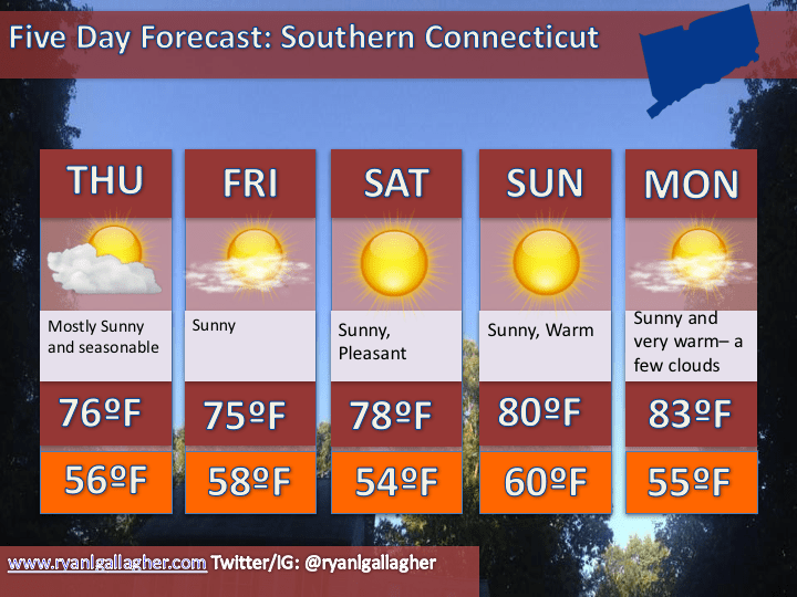
Graphical Forecast:


Leave a comment