Tropical Storm Phillipe will become post tropical as it tracks up towards the Gulf of Maine. It will stay far enough offshore to spare any direct impact. A deep upper trough in the midwest will become what we call “negatively tilted” (which means its axis will become more NW to SE oriented across the region).
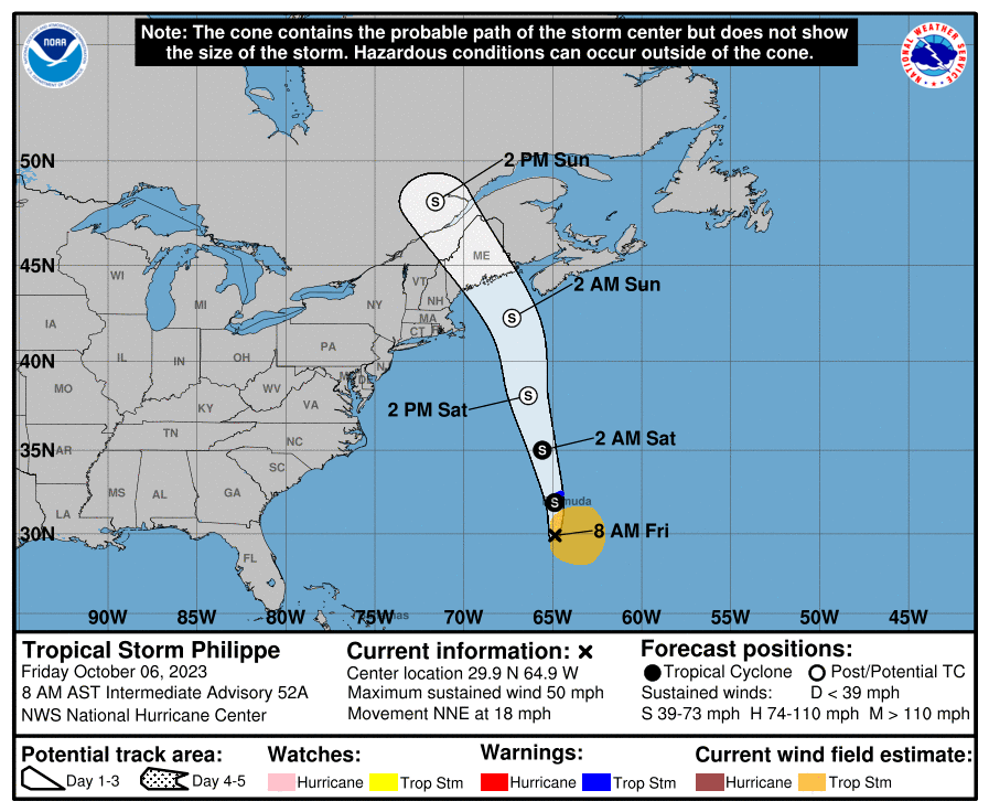
The 8 AM Friday Advisory From The National Hurricane Center
A slow moving but sharp cold front will approach western New England tonight into Saturday morning and pivot across the region as Phillipe passes into downeast Maine/nearby Canada. The front will be the focal point for most of the rain and the intensity will really depend on how much of Phillipe’s moisture it is able to tap into.
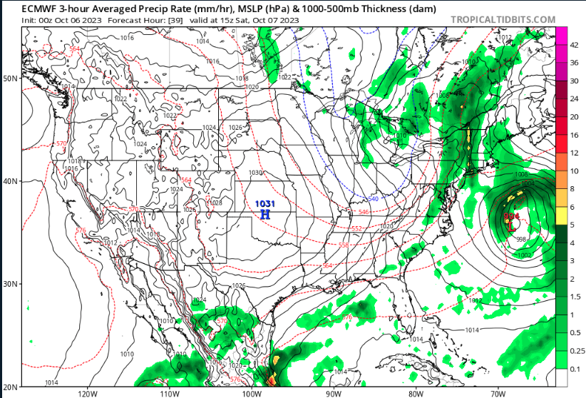
- Image from tropicaltidbits.com
It trending to be a bit wetter in western Connecticut versus eastern Connecticut with 1″ to 1.5″ rainfall totals west of I-91 and 0.5″ to 1″ east by the time this wraps up Saturday evening. We’ll have to watch the new data this afternoon because the zone of heaviest rain may have some 1.5″+ totals. Right now this is most likely in north central Connecticut between the Farmington and Naugatuck Rivers.
Here is quick snapshot of what the weather will look like across the state with morning fog giving way to mostly cloudy skies today:
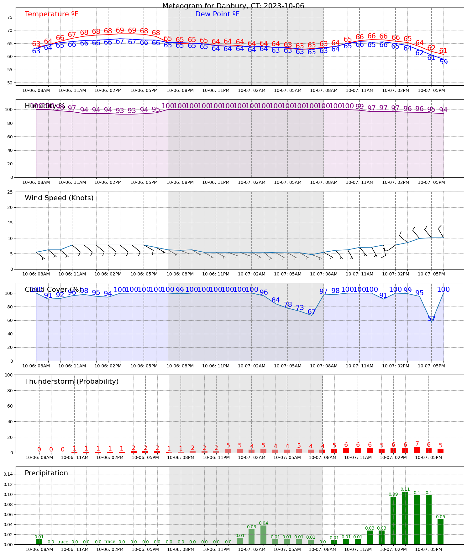
Today should be mostly dry notwithstanding a few passing showers with the better chance for rain showers emerging tonight. The steadiest rain will be mid-morning to mid afternoon Saturday in western Connecticut and a little bit more afternoon to evening focused east. Note the sharp change in wind direction to northwest in the mid to late afternoon. That is our cold front passage which will bring in the chilly weather for Sunday and Monday

Leave a comment