At 22 UTC, 6 December 2011, KOKX was reporting light rain with a temperature of 56F. A stationary front was located across the interior northeast stretching all the way down the Appalachians into Central Alabama. Aloft, a 500mb shortwave trough is positively tilted from Michigan to western Texas. Moist southerly flow is out ahead of the front and drier northwesterly flow around behind it.
During the next couple days, this stationary front will be a boundary on which several pulses of energy will try to ride it. The first of which is bringing the rain to the region today, and the second of which could be a bit more potent and have some additional cold air to work with. Very important during this entire period is the evolution of the upper level pattern. The vorticity advection associated with the 500mb trough is stronger further south. As a result, geopotential height falls will be more significant over northern Louisiana and Alabama then they will be in the midwest. Expecting this as a result to be less of a factor as a long wave trough in Canada picks this up. Main surface low track will be along the coast.
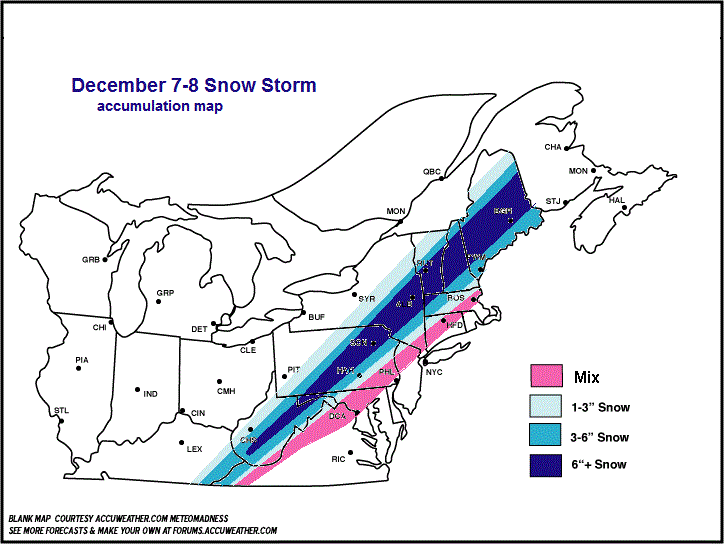
The upper level pattern is just not conducive for the big cities at this time. The axis of heaviest snow looks to be a bit north and west of where it was during the Halloween storm in the northeast but much lesser in magnitude.
Well, now what you’ve been waiting for – THE MAP!! Enjoy!


Leave a comment