An upper level shortwave stretching from the Great Lakes to Georgia is currently swinging around a broader trough with an axis over central Canada and the high plains. At the surface, a low near eastern lake Ontario is starting to show signs of occlusion as it progresses northeast. Strong southeast winds out ahead of it have eroded the cold air out of most of New England except Northern parts of New Hampshire and Maine.
This low will continue to track across northern New England and through central Maine over into Canada later today. The associated cold front will pass through Connecticut early this evening accompanied by strong Northwest winds well into the night.
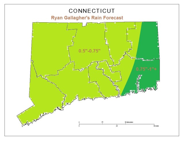
Here’s essentially what I expect as far as total rainfall from today – a bit less than the range I mentioned overall yesterday, but a few Eastern spots may still have the opportunity to reach the 1″ mark
In other news, I’m trying to get excited about some snow.. the only thing I see as far as next week goes is a chance of flurries. Anything else we have to look past Super Bowl weekend for!

Leave a comment