A classic setup for the region’s first major fall rainstorm is in the making. A highly amplified upper level pattern will emerge with a deep 500mb trough over the Midwest and a strengthening Atlantic ridge downstream. This will set the stage for an intensifying surface low to develop and track northeastward near western New England. A strong cold front to the south will then push across the region late Tuesday and Tuesday night. Heavy Rain, Strong winds and even a few severe thunderstorms are some likely effects of this system.
Behind the storm will be another round of sunny days and cool morning lows. The presence of Fall will continue to become evident in the next few weeks! Stay Tuned!
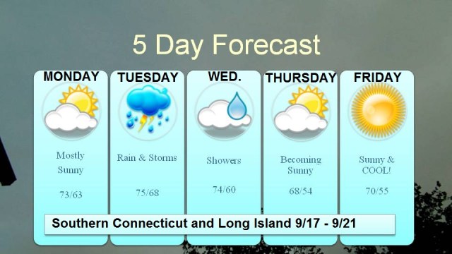
Here’s the Five Day
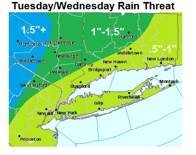
Here’s what we are expecting for rainfall across the region:
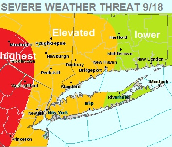
And Here is a look at the possibility for severe weather. There will be more forthcoming with regards to the specifics of that threat during the day tomorrow.


Leave a comment