The cold will finally begin to release it’s grip on the region this weekend. Across the state we had a light snow event move on through last night that left most with a general dusting of new snow. The place to be was the south shore of long island, where some more moderate snow bands set up anywhere from the Rockaways to Long Beach out to the Hamptons and the South Fork. These places picked up 1.5″ totals and even some higher amounts!
With the blazing sunshine and dry conditions this weekend, we’ll look for temperatures to gradually moderate. Tomorrow may even yield some above freezing temperatures for New York City and coastal locations for the first time in six days! A warm front approaches the area late Monday afternoon and that’s when we could contend with our next round of precipitation. Here’s a snapshot of that on the 6z GFS:
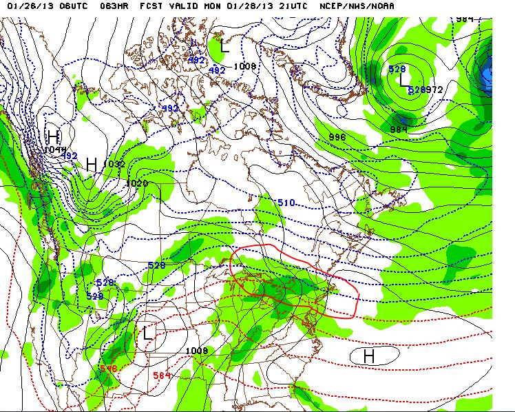
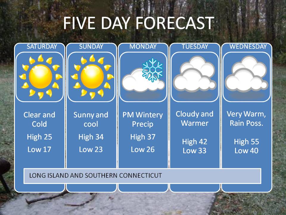
We’ve seen this before – that trough digging in the west and ridging starting to show on in the east. A brief round of snow is possible changing over to ice and rain depending on how long the precipitation lasts. That low in the Rockies will then intensify and track northeast up into the central US/western Great Lakes. It will work to really pump up that ridge in the east on Tuesday. Get ready for a spell of very warm weather – especially Wednesday. Temperatures could make it well into the 50’s for some areas. Even that won’t last – it looks like some cold will follow for the beginning of February! Let’s save that for the next blog topic though. Here’s the Five Day – Have a Great Afternoon!

Leave a comment