An Upper level low is located to our north in Eastern Canada and an upper level high to our south in the Bermuda triangle. The 500 mb pattern above us shows a general west to east flow. At the Surface, a cold front is pushing across the eastern seaboard with low pressure to our north and east, and high pressure to our south and west. Humidity levels should fall through the weekend in the wake of the front with dew points starting off in the lower and middle 70’s and dropping to the middle and upper 50’s.
I’m expecting high pressure to continue to build into the region tomorrow and Sunday. Winds should remain light and out of the west on saturday, and light and variable on Sunday.
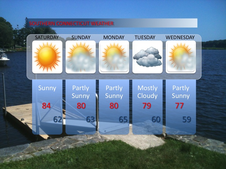
Over the next 5 days, high temperatures will generally be in the lower 80’s, and may not exceed the upper 70’s by the middle of next week. No significant precipitation is expected until the middle of the week as another cold front approaches the area on Tuesday.

Leave a comment