Discussion: A relatively flat 500 mb pattern continues with low pressure to the north and high pressure to the south. At the surface, high pressure is in control for much of the east coast and an area of low pressure continues to pull away from far eastern Canada.
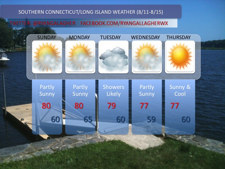
A shortwave trough will pivot on through towards the middle of the week and with it our next chance for some unsettled weather. On tuesday a cold front boundary will reach the east coast, along which there will be sufficient forcing for some region wide rainfall in the form of scattered showers and thunderstorms. Drier conditions will return by the second half of the week.
Temperatures with the exception of tuesday and wednesday, where highs won’t get out of the 70’s should remain right around normal with highs in the 80’s.
 Forecaster: Ryan

Leave a comment