Our storm is taking shape in the southeastern US today. Steady snow can already be seen pushing into northern Virginia and metro Washington DC.
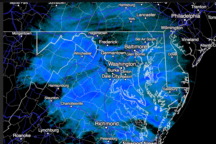
This has the makings of a historic impact for the region with blizzard conditions and feet of snow.
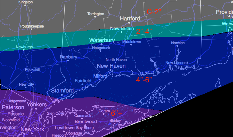
Further north, the concern has been how far north the impacts get. Confidence is increasing in a moderate snow event for coastal southern New England. Snow develops tomorrow morning. It gets heavy during the afternoon and evening and tapers off during the morning on Sunday.
I’m not making any major changes to my map, the cutoff get really sharp heading inland from coastal connecticut. Long Island sound continues to be the dividing line between either side of 6″ of snow. High winds are likely at the height of the storm generating near blizzard conditions especially when heavy snow is falling. Gusts exceeding 50 mph is a concern.

Leave a comment