Discussion:
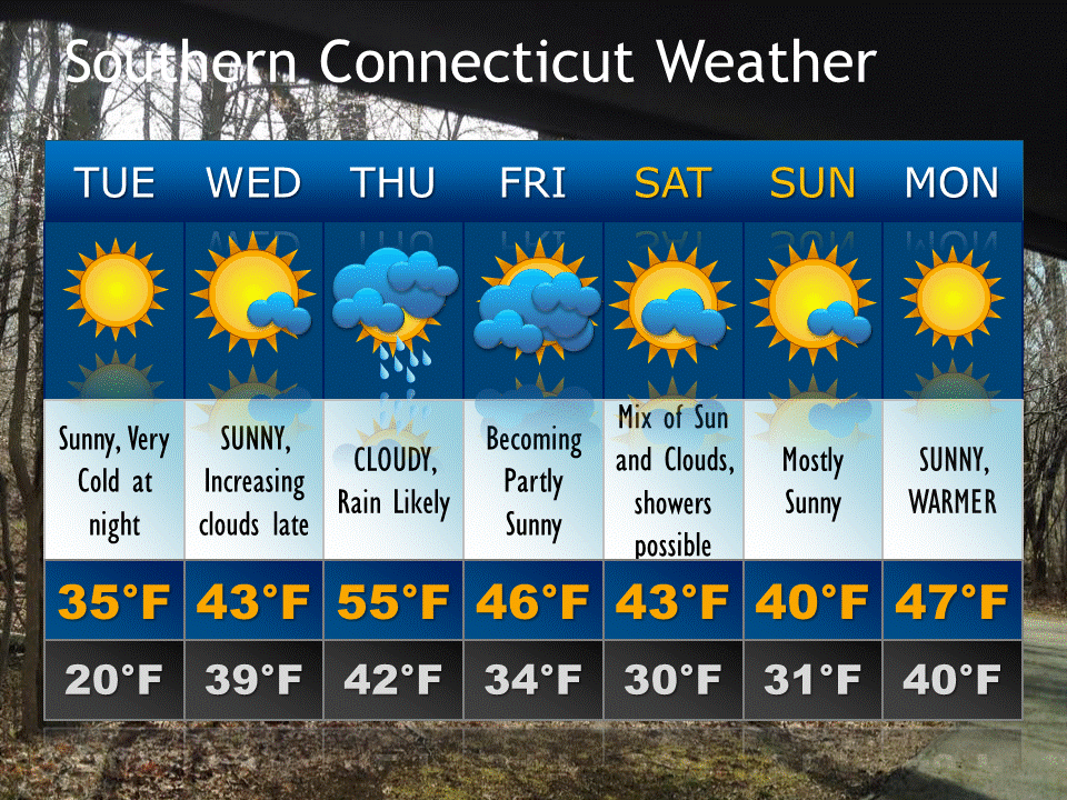
Surface: High pressure moves in for Wednesday and departs to our east on Thursday. A clipper system approaches Friday, pulling a cold front through for the weekend.
Upper Levels: Some ridging builds in through Wednesday. A deepening trough kicks in during the second half of the week and remains in the vicinity for the weekend.
The temperature roller coaster continues this week as a cold airmass associated with Canadian high pressure is in place tonight and tomorrow. Things warm up a bit on Thursday into Friday as deep layer southwesterly flow develops starting Wednesday night between the departing high and an approaching low pressure system/its associated cold front. Some downpours are possible Thursday night along and ahead of the frontal boundary with moisture in place and convergent frontal forcing.

Leave a comment