Discussion: An unsettled weather pattern late this week will bring rain, large swings in temperature and a couple more opportunities for crop killing freezes this weekend.
Surface: Cold Canadian high pressure is in control today. This will slip offshore to our east tonight and Thursday. Southerly flow develops between a low in the midwest and the departing high which will bring in a milder and more humid airmass. A cold front approaches Thursday night while a low itself tracks near or over northern New England with possible secondary development in southern New England. In the wake of its departure a weak clipper system tracks just south of the region on Saturday.
Upper levels: Some weak ridging is present today. A large, deepening trough approaches from the west on Thursday and lingers through late Sunday before weakening and departing.
Forecast
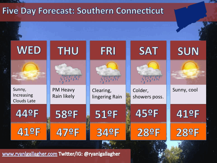
Today: Sunshine gives way to increasing clouds this evening. Temperatures steady or even rising a bit overnight.
Thursday: Mild with rain expected ahead of an approaching cold front. Gusty south wind. The rainfall could be heavy, especially late.
Friday: lingering rain but turning drier as the day goes on. More clouds than sun. Turing much colder overnight.
Saturday: Cold. Breaks of sun in the morning with overcast skies and a threat of late day rain or snow showers.
Five Day:


Leave a comment