The pattern change cannot come fast enough, but unfortunately seems to be preceded by a historic wildfire outbreak in the deep southern portions of the state. As of this report on the evening of 4/22, there are two large fires ongoing with limited containment.
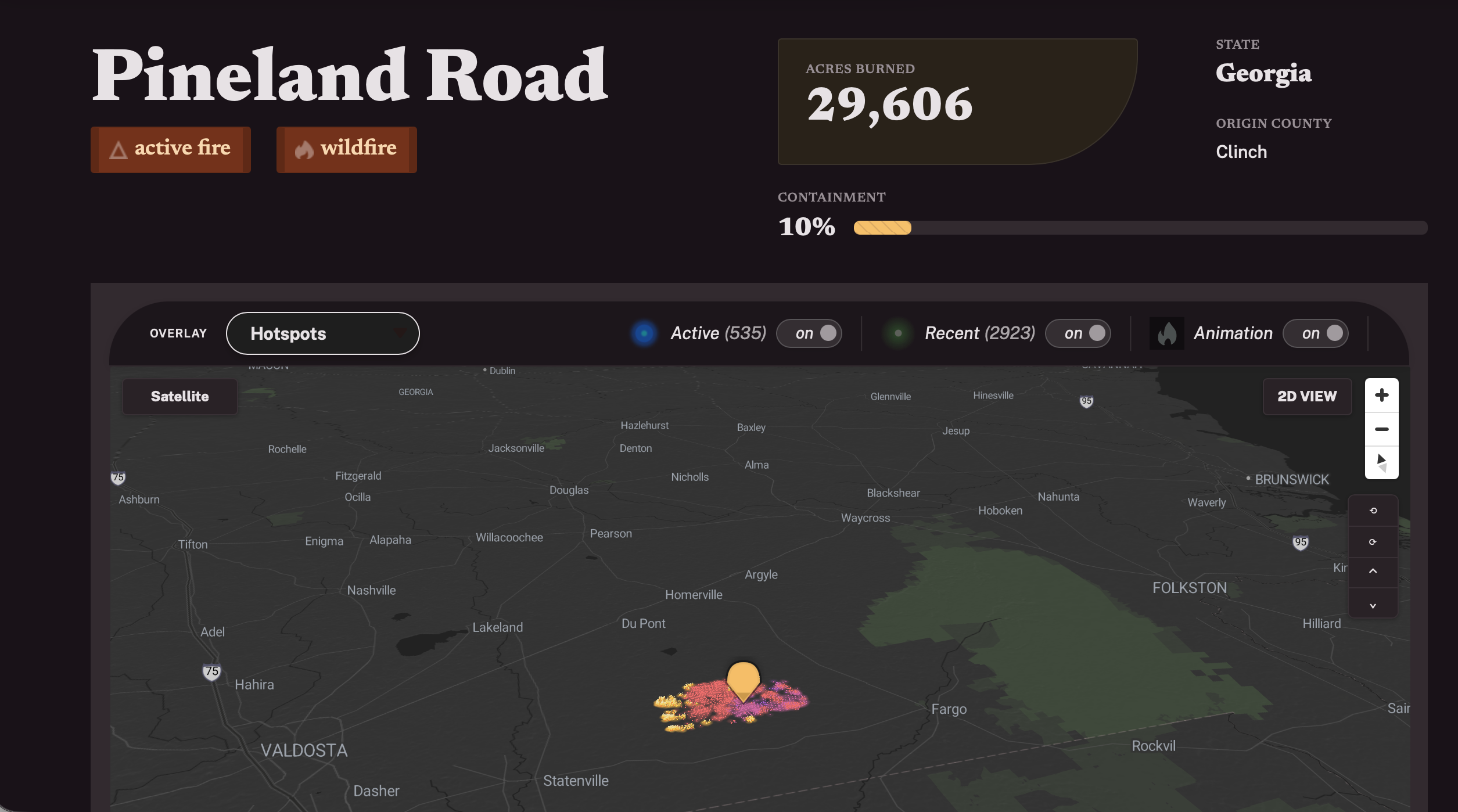
The first and by far the largest the Clinch/Echols County “Pineland Road fire” which is said to have burned nearly 30,000 acres as of 8 PM Wednesday! It is located in a large rural area between Valdosta and the Okefenokee Swamp.
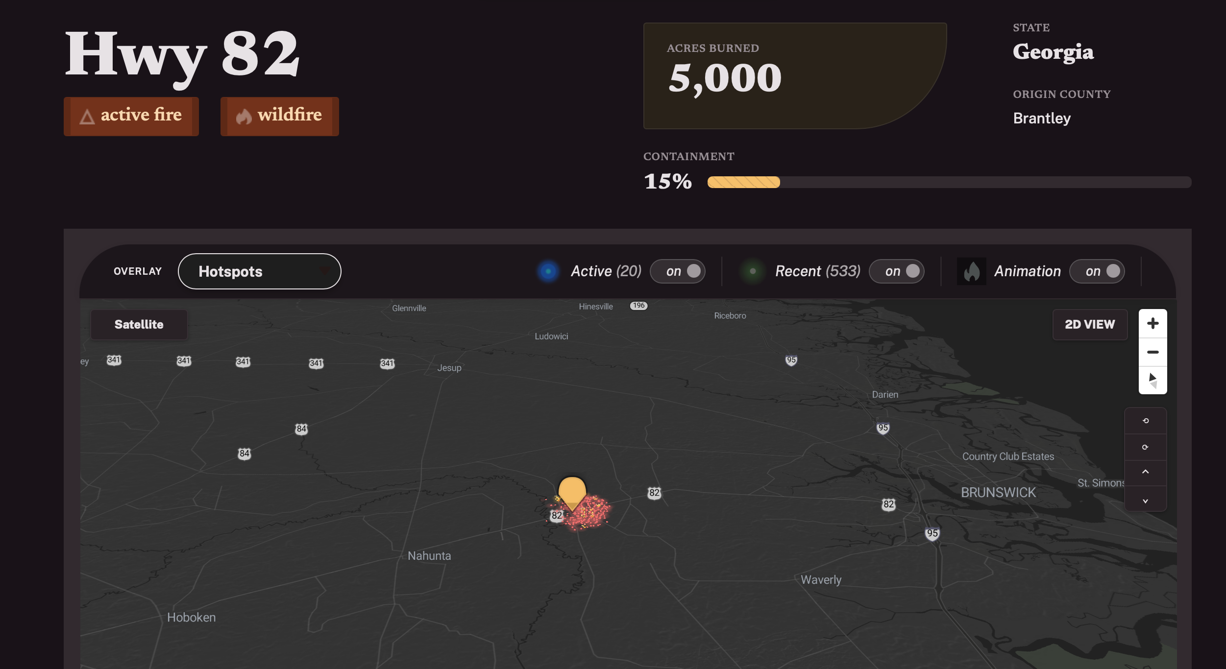
The second in Brantley County is just west of Brunswick along Highway 82 and has reached 5,000 acres. It’s fairing a little better with 15% containment as of the Wednesday evening report.
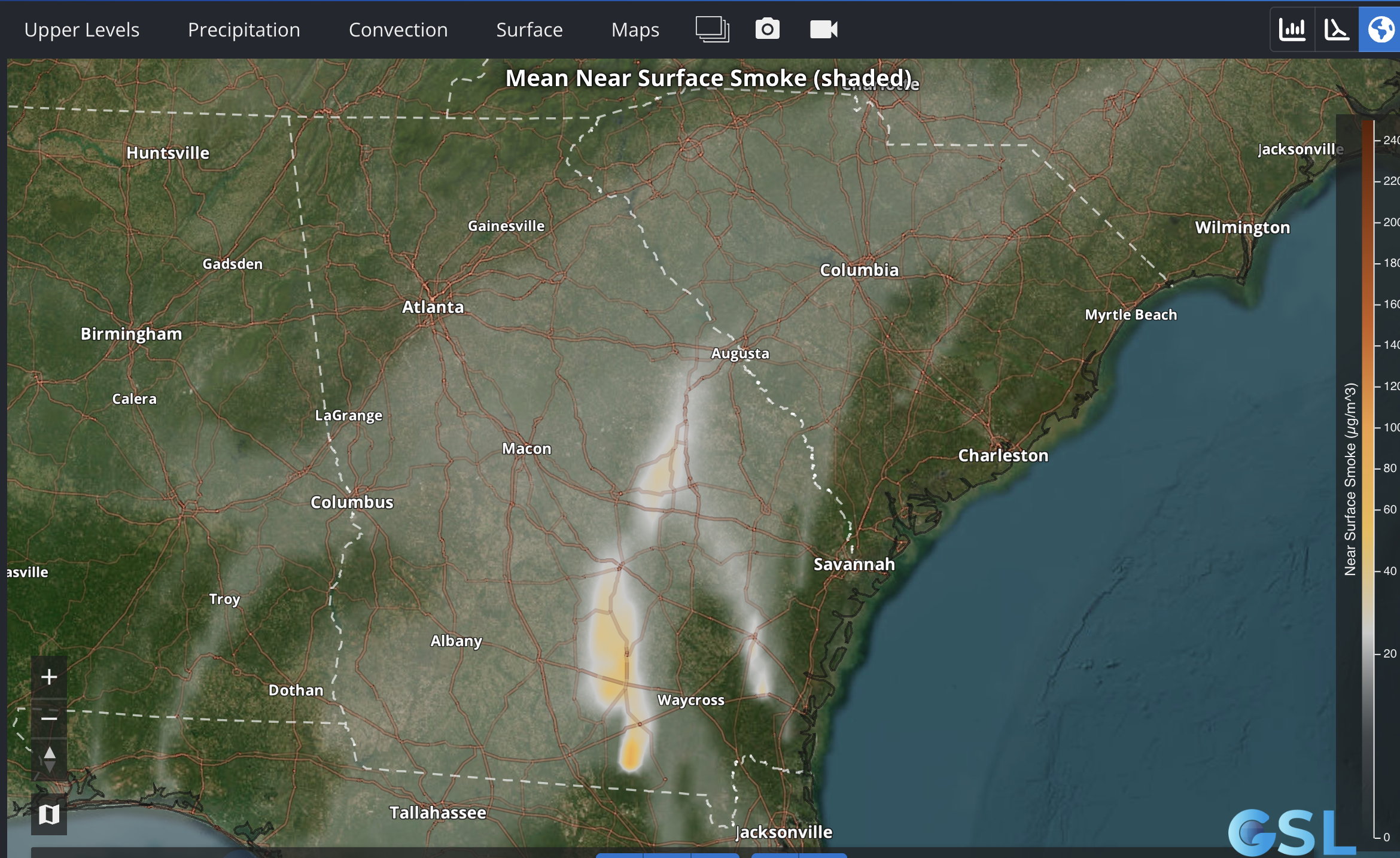
Smoke from these fires is impact a large area of the Peach State, into and including Metro Atlanta – but particularly for areas along and south of I-85. Air quality alerts have been hoisted for Metro Atlanta, Metro Augusta and much of central and western South Carolina.
So when should we expect relief?
A cold front will approach the region Friday evening. It should bring with it a wind shift as well as a round of showers and thunderstorms Friday night into Saturday. Both of those things should bring improvement first to our air quality, and secondly some relief to the communities most directly affected by the ongoing fires. There is still some uncertainty with when most of the rain will fall. Right now it appears like it could be focused more on the early part of the day Saturday with a lull in the afternoon and evening perhaps lingering through Sunday.
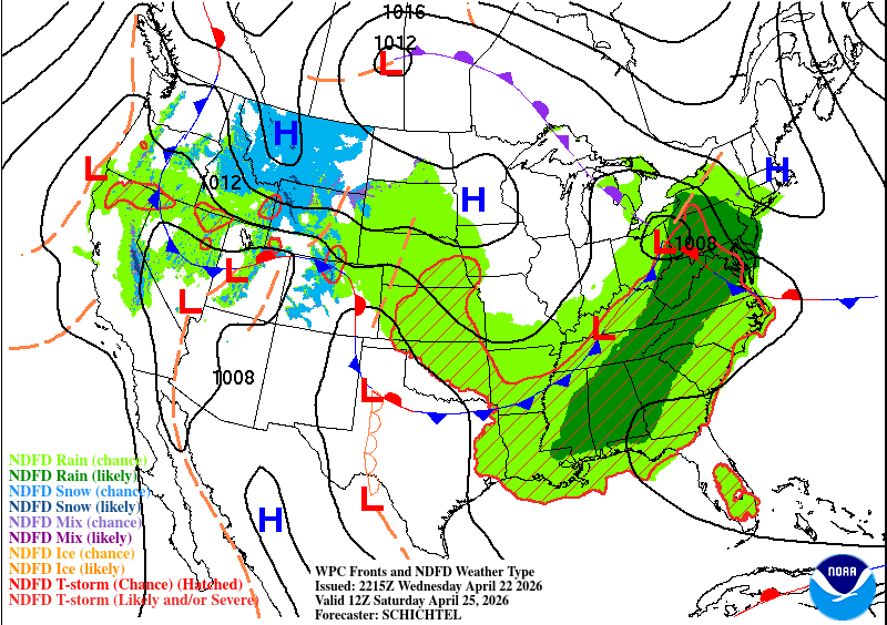
A more significant round of showers and thunderstorms will likely come through Monday into Tuesday. Details will be refined as we get closer.

Leave a comment