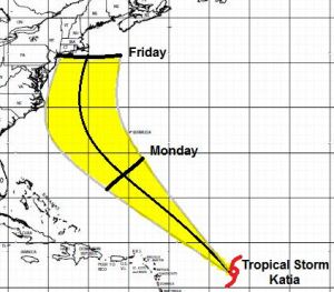
A quiet first half of the weekend lead to a downturn by Monday night. Heavy rain from the remnants of the tropical storm in the gulf will be amplified by the passage of a cold front on Tuesday. Looking ahead to the late week – that Pacific-Atlantic connection between ridges is starting to become more apparent. We are looking for a strengthening Bermuda high while a less than impressive trough becomes situated over the spine of the Appalachians. Not unlike Irene, this may give Tropical Storm Katia the opportunity to track closer to the coast, potentially as a hurricane.
Here is my Updated Map:

Leave a comment