Discussion: The humidity will gradually increase as we head into Saturday. Mix of sun and clouds, some morning fog with a stray afternoon shower or thunderstorm. High near 80. On Sunday rain and thunderstorms develop ahead of a potent cold front. With precipitable water values approaching 2″ Sunday evening, heavy downpours are a virtual certainty in any thunderstorms that develop. The chance for strong storms with an isolated damaging wind gust appears to be most likely in central and northern New England. Cooler drier weather for Monday night into Tuesday with sunshine. Continued sunshine with warming temperatures increasing humidity will be the story nearing the end of next week.
Upper levels: A broad upper level ridge will fade to the east over the next couple days. As it does so a shortwave disturbance will ripple through this weekend. A deep trough approaches Sunday and pushes through on Monday. Some more ridging gradually builds into the middle of next week.
Surface: Backdoor cold front stalls just north of our area this afternoon. High pressure gradually departs to our east into tomorrow introducing a warm and humid southerly flow into the weekend. A low pressure system will then track up through the great lakes into Canada dragging a cold front across our region Sunday night into Monday. High pressure takes control for much of the week.
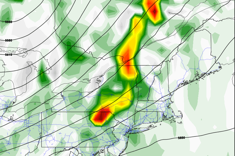
500 mb vertical velocities strongest across the interior northeast, up into central and northern New England for Sunday indicate mid level forcing staying just north of Connecticut. Now the NAM, which I will not show, indicates a situation in which a deeper through develops and brings some of that stronger upper level forcing further south. Instability is progged to be weak indicating to me a more general rain and thunderstorm threat with perhaps an isolated damaging wind gust late Sunday.
Additional note: We’ll be keeping an eye on things next weekend as a couple of our forecast models are hinting at tropical development nearing the east coast in the long term (after August 28).
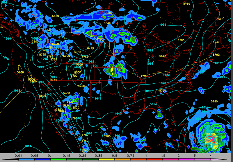
This is a snapshot of August 28th in this morning’s 06UTC GFS run. Very little information should be extracted from one model run more than a week in advance. The east coast should monitor tropical forecasts as we approach peak hurricane season in September. Climatologically speaking it takes some very special circumstances for a tropical storm to threaten Connecticut in a damaging way. They typically have to thread a needle from the Bahamas to the outerbanks of North Carolina to avoid traveling over too much land and weakening or recurving out to sea. Sandy was an exception in that as it went through extratropical transition it got picked up by an upper level trough and was steered into the coast. More often the upper level steering doesn’t work out that favorably for these kinds of storms.
Seven Day Forecast:


Leave a comment